
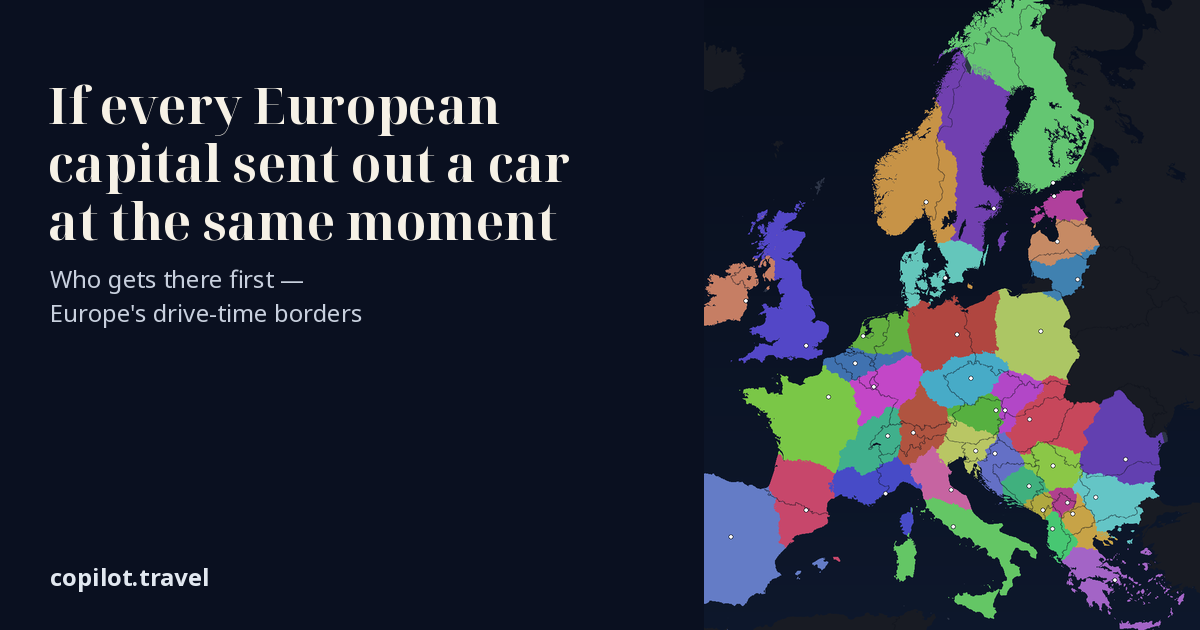
Who would get where first?
Also, the animation doesn’t run for me. I allowed JS, but still no go, probably something in LibreWolf preventing it.
Thanks, that was a real bug: LibreWolf’s fingerprinting protection blocks reading back canvas pixels, and the map read its data that way. It now decodes the data directly, so it should play for you after a reload.
“Where” = every place in Europe: each spot is coloured by the capital whose car reaches it first, if all 38 cars leave at the same moment. Tap any place on the map (or type a town) to see who gets there first, second and third, with the drive times.
Data: drive times computed on the OpenStreetMap road network (roads and ferries © OpenStreetMap contributors); coastlines and borders: Natural Earth.
Tools: Python (NumPy, Pillow) for the drawing, ffmpeg for the GIF. Method: for each of 38 capitals, the drive time to every point on the road network, non-stop at typical road speeds with no traffic;
Ferries at their sailing time with no waiting. Each spot is coloured by the capital whose car arrives first. Equal-area projection, so the territory sizes are true km².
Grey: not in the race (Iceland, Malta, Cyprus, Ukraine, Moldova, Belarus, Russia, Turkey). Dark: no car within 18 hours. Some results: Berlin’s car reaches only 37 % of Germany first; Liechtenstein’s car reaches Zürich in about an hour, before Bern’s;
Monaco’s car claims about 94 500 km², roughly Portugal; Dublin’s car takes the Belfast ferry and wins south-west Scotland.
